Description
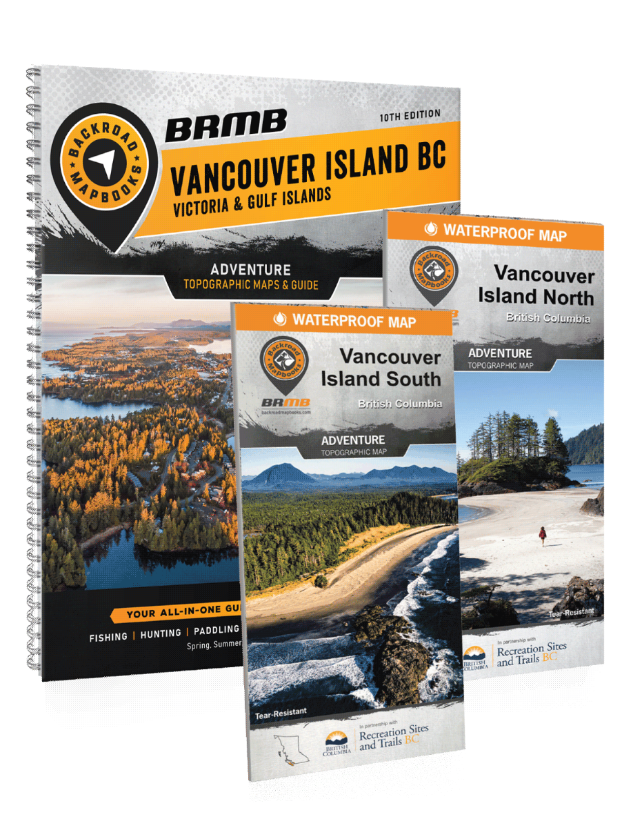
The Ultimate Waterproof Map Bundle for your Vancouver Island AdventuresVancouver Island BC Backroad MapbookKnown for its beautiful landscapes, abundant wildlife and laid-back atmosphere, Vancouver Island is just a short ferry ride away from the bustling Lower Mainland but often feels like an entirely different world. Though the city of Victoria in the south of the Island offers every modern convenience (and plenty of colonial charm), as you move north and west along the Island the cities get smaller and further apart, the trees get bigger and your opportunities for outdoor adventure grow exponentially. From surfing and whale-watching in Tofino to viewing some of the world’s largest trees in Strathcona Provincial Park, Vancouver Island’s natural treasures have to be seen to be believed. Get away from it all on a multi-day hike along the West Coast Trail, reel in the catch of a lifetime in Campbell River, the Salmon Capital of the World, or explore the many charming Gulf Islands – Vancouver Island is yours to discover.The 8th edition of our Vancouver Island Backroad Mapbook features extensive updates and upgrades from our last publication. These include the addition of private land, fish species, higher resolution for wildlife management units, enhanced and updated resource roads, cartographic symbol updates, multi-use trail and fish stocking charts and four new maps at 1:150,000 base scale, as well as an inset map of the Sayward Canoe Route. As usual, we have also expanded and refined our written Adventure listings to get you the most up-to-date and accurate information possible for your adventure of choice.Vancouver Island BC North Waterproof MapFeaturing vast stretches of undisturbed rainforest, towering mountains surrounded by pristine lakes, thousands of kilometers of coastline teeming with marine life and a variety of quaint, charming communities, Northern Vancouver Island offers endless opportunity for adventure. With just one major roadway reaching the northern extents of the Island, this is a place where nature rules and stress melts away. A secluded sandy beach or isolated campsite is never too far away, and often your chances of seeing a whale swimming offshore are better than spotting another human. From salmon fishing in Campbell River to hiking in Strathcona Park and Cape Scott or paddling the shores of Brooks Peninsula Park, there is no shortage of recreational opportunity on Northern Vancouver Island.To make navigating this sparsely populated region easier the BRMB team have worked tirelessly to create the most comprehensive, detailed and easy to use map for Northern Vancouver Island you will find anywhere. This dual sided 34″ x 46.25″ map is printed on durable, waterproof paper to withstand any storm or gale. With industry-leading cartographic detail, state-of-the-art relief shading, colour coded Provincial Parks and more, there isn’t an easier to read map on the market. This map contains countless points of interest, hiking trails, campsites, beaches, paddling routes and more, so no matter what you are looking for, you can find it on our Northern Vancouver Island Waterproof Map. This map also features detailed descriptions of recreation sites and parks with information on camping, fees, activities, access and more. Covering the areas around Port Hardy, Port McNeill, Gold River, Campbell River, Courtenay/Comox and more, this is your ultimate guide to exploring one of the most breathtaking areas in the world.Vancouver Island BC South Waterproof MapFrom the breathtaking wilderness of Strathcona Provincial Park to the historic Victoria waterfront, Southern Vancouver Island is a land of diverse recreational opportunity. In the north of the area covered by this map, Mount Washington offers world-class skiing, snowboarding and mountain biking. To the west, Tofino is a surfer’s paradise, widely regarded for having the best waves in Canada. The vibrant rainforests of Pacific Rim National Park offer stunning hiking and camping, while the many small towns that dot the Island’s coast are hot-spots for fishing and whale-watching. Found in the southeast section of this map, the Gulf Islands are one of Canada’s hidden treasures and the perfect place to slow things down and get lost for a little while. Taking in everything Southern Vancouver Island has to offer is impossible, but this map will certainly get you started on the right track.To help you discover the best of Southern Vancouver Island, the BRMB team has worked tirelessly to create the most comprehensive, detailed and easy to use map for Southern Vancouver Island you will find anywhere. This dual sided 34″ x 46.25″ map is printed on durable, waterproof paper to withstand anything Mother Nature throws at you. With industry-leading cartographic detail, sate-of-the-art relief shading, UTM and longitude/latitude grid, colour coded Provincial Parks, Wildlife Management Units, Recreation Sites and more, you can stay focused on your adventure and not on trying to decipher a hard-to-read map. This map is jam-packed with points of interest, hiking trails, campsites, paddling routes and more, so no matter what your favourite outdoor activity is, we’ve got you covered. This map also features detailed descriptions of recreation sites and parks with information on camping, fees, activities, access and more. Covering the areas around Duncan, Tofino, Bamfield, Victoria, the Gulf Islands and more, this is a must-have for any Vancouver Island adventure.
